INTRODUCTION:
Maps are introduced in oracle apex to show the exact locations and information in a simple way. In this blog, we are displaying the latitude and longitude by pointing the location.
WHY WE NEED TO USE:
It helps to search the locations in an easier way. APEX allows us to represent it in different forms such as:
- Points – a single point that let you know the location.
- Lines – lines where two points are connected to know the location.
- Polygons – entire areas with boundaries determined by several straight lines.
- Heat Maps – Point Objects displayed as a Heat Map. Useful, for example, for visualizing the density of point objects.
- Extruded Polygons – polygons shown as 3D objects to visualize height. The height is based on a result column value
Now, we are going to point the locations by using points.
STEPS TO SOLVE:
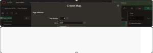
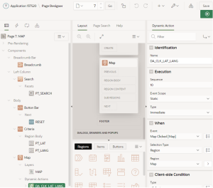
Step 1: Create a page by selecting the ‘MAP’. Also select the table name.
Step 2:
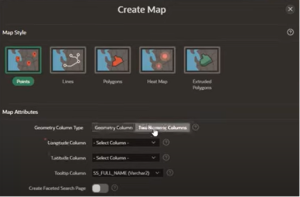
Select the map style as ‘points.’ Select geometry column type as ‘Two numeric column.’ Also select the longitude, latitude column and tooltip column.
Click on create page.
Step 3:
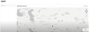
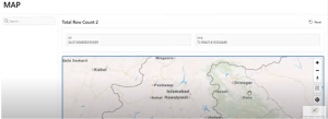
The page appears as,

Step 4:
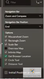
Change the settings to background as ‘custom,’ ‘standard’ and ‘dark mode’ as ‘Oracle world map’ and enable the options whatever you want.
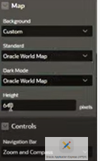
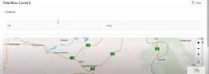
You can view your location now.
Step 5:
Click a new page item and name it as ‘LAT’ and ‘LONG.’
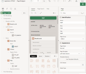
Step 6:
Create another region called ‘Criteria.’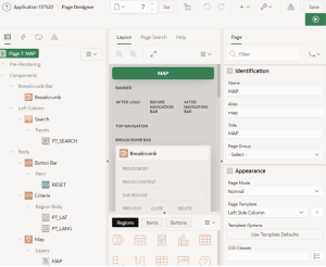
The page appears as,
Step 7:
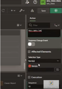
Now, create dynamic action ‘DA_CLK_LAT_LANG’ and make the necessary settings of when the event to happen. ‘Set the action’ to
‘set value’ and ‘set type’ to ‘JavaScript expression’ to ‘this.data.lat’ for latitude and ‘this.data.long’ for longitude.
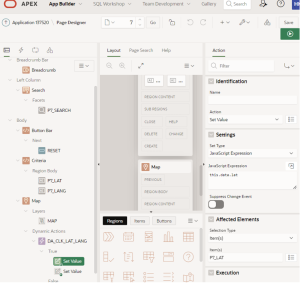
Change the when event to ‘MAP [clicked].’
CONCLUSION:
When we point the location, we can know the latitude and longitude. It can also be made simple with faceted search.